Darting forlorn looks at the placid harmony that would soon be memory, I headed out of Sauraha, the village where I was staying. From Sauraha, I headed to Bharatpur town where the airport was located. The bumpy ride would take close to an hour. Since the flight was only in the late afternoon, I asked the driver if we could take the scenic route – via the 20,000 Lakes. The 20,000 Lakes is slightly less than an overstatement. It is actually a whole area covered by numerous little water bodies, each the size of an Olympic swimming pool. I counted less than a 100; ‘20,000’ sounded like somebody lost count and got a bit exasperated. That was just one version of the nomenclature. The other version is that nobody knows how or from where it got its name. Whatever, the good part is that the place is yet to make an appearance on the tourist map. But on the flip side, the approach road is accessible only by jeeps or SUVs.
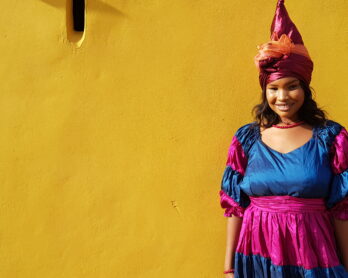
Among the numerous little lakes, there is one main lake which is the 20,000 Lake. This is locally known as Aam Taal; aam means mango and taal is lake (no, there weren’t any mangoes in the lake, I checked). The bank of the lake is swamped with a grass called karothi jhar– used by the locals to feed livestock. Beneath this thick blanket of the razor-thin grass, it is not unusual to find a napping crocodile. The 20,000 Lakes used to be popular among the locals as a weekend or picnic spot. However, it didn’t take long to lose its lure – due to the napping crocs.Bharatpur is five hours by road southwest of Kathmandu. By flight it takes less than half an hour. So I reached Kathmandu early afternoon on the day of Teej celebrations. All the women were dressed in blood-red saris with twinkling attachments and other ornamental fineries. Though festivals are almost every second day in Nepal, Teej is among the biggest, most colourful and is celebrated with much aplomb. The guys make way for their women who take centre stage who do so with much gaiety and it is not uncommon to see impromptu dance sessions right on the roadside – to the accompaniment of high pitched singing and clapping. After filling up with pretty women and with a voice gone hoarse wishing every smiling face a ‘Happy Teej’ I decided to take off to a new destination fast rising in stature in Nepal’s tourism map.
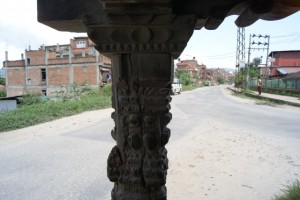
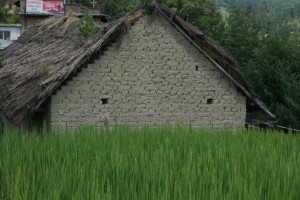
Nagarkot is 30 kilometres from Kathmandu town. After the left turn towards Bhaktapur town, the climb begins on a gradual note. The drive is a marked deviation from the smoky haze of Kathmandu roads. Vast expanses of green fields cuddle the road from both sides. The architectural legacy of Bhaktapur, the city of devotees, can be found even when you are passing by – there are figurines in stone right by the side of the road as if waiting endlessly waiting for the bus and a structure which would have been a waiting shed if buses were plying a thousand years ago (which was actually a waiting place for the walk-weary). Endless green fields stretched on both sides of the road, punctuated by intermittent concrete structures. With progress happening at a rampant pace, new constructions spilled out into every available space. And that included the paddy fields I was passing through. Though recognised as one of the banes of haphazard development Kathmandu is undergoing today, there seems to be no respite to the increasing encroachment.Decades ago, the fields were forests which were cleared for habitation. With increasing traffic between Kathmandu and Nagarkot, the rusticity of the mud houses may not be around for long. Steel and cement buildings rise like unwelcome blots amid the lush green fields. The authorities seem resigned to the grim fact that nothing much can be done with the thousands pouring into the capital and settling down on the valley fringes. With the city sagging at its seams, options for the tourist reaching saturation points, it was only a matter of time that gazes shifted to alternate destinations. Like Nagarkot. Climbing higher, the green got greener and the concrete sparser. Save for little clusters of agrarian outposts, the tentacles of the city were left far behind. Far away in the distant hills gleamed the tin tops of Nagarkot houses. Nagarkot means ‘fort of the city’. Occupying a strategic location in the ancient trading route between Tibet and Nepal, the town is historically relevant as a trading outpost. Perched at an altitude of 2165 metres, the mountain township is several degrees cooler than Kathmandu. All these has made Nagarkot a favoured weekend destination for those looking for a respite from the capital’s heat and dust. It is also preferred by courting couples for its peace and quiet. And suddenly, I was in Nagarkot.
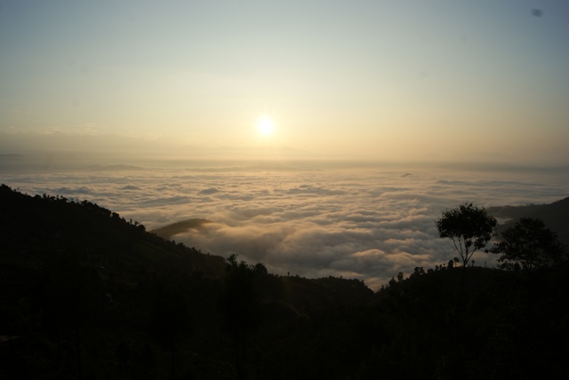
One of the reasons for its rising popularity is its proximity to Kathmandu. My taxi driver informs me that some tourists don’t even bother to get into Kathmandu town – they come here directly from the airport itself. The trip takes hardly half an hour. Being over two kilometres above sea level, from Nagarkot the Himalayas are visible on a clear day. As dusk fell, I could see the majestic snow-clad mountains in the distant horizon nodding off. The hills around were slowly snuggling under the blanket of clouds.
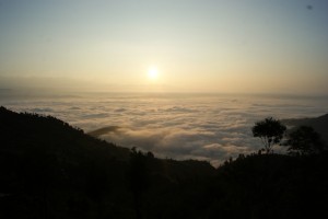
Tourism was a late-comer in Nepal, making its appearance in the 1960s only. Hence it was only much later the resorts and boutique hotels came up in neighbouring Nagarkot. But today, all kind of creature comforts are available here to suit every budget. I had to make sure that I didn’t get too carried away as I had to catch the sunrise here – something which Nagarkot was famed for. So the next morning, I was up, as were 50 Japanese with clucking Nikons in the main balcony next to mine, at 6am. While I had hardly enough time to pull the bathrobe around me, my neighbours were all dolled up in impeccably tailored suits and jackets – I almost expected them to ask the sun out for dinner soon as it came out. The sunrise in Nagarkot was definitely better than the sunset in Chitwan. Then sunrises are any day better than sunsets. Anywhere.
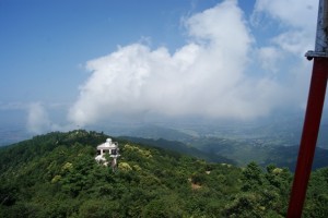
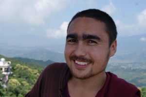
The rising sun slowly unfurled before me the resplendence of the surrounding mountains. The Himalayas in the horizon were clearer than they were yesterday. But I wanted a better view for which I clambered up a watch tower, a short drive from the hotel where I was staying. The town was slowly shaking off its slumber. The only ones on the street were the nattily dressed school children. And the Japanese who had slowly started to staccato down the winding roads pointing their Nikons at rising chimney fumes and overlooked flora. Peopled mostly by Tamang and Bahun tribes, who depend mostly on agriculture, the town was yet to fully realise its tourism potential like next door Kathmandu. These people rely mostly on their land and seemed to be perfectly content with whatever they had – their happily mooing cattle and chirpy children traipsing to school.While I stood transfixed and a little startled on the top of the View Tower at the total lack of any semblance between what I saw in the horizon to the shapes in the map I held in my hand, I saw somebody looking at the mountains with a dream-happy smile on his face. Konchok Dorjay was a Buddhist monk with bushy brows over waterfall-green eyes – one hunk of a monk. Hailing from a village close to Ladakh and a descendant of the original Aryans, Konchok came to Kathmandu as a 15-year-old. Completing his masters in Tibetan philosophy he was now gunning for a doctorate. Like me, he too clambered up this rickety tower for the view. An adventurous monk with an eye for beauty.
The land acknowledged the compliment by sending a gentle cool waft of a breeze over us, billowing Konchok’s red and saffron habit. The clouds floated right next to our eyes framing the landscape in an ethereal beauty. Nagarkot rolled on in front of us with its meandering valleys, the rumbling in August monsoon clouds and the whiff of a rainbow conjoining heaven and earth.


